Muncie, Indiana
Key Services:
→ Comprehensive & Neighborhood Planning
→ Corridor & District Frameworks
→ Zoning Strategy & Policy Alignment
→ Implementation & Action Steps
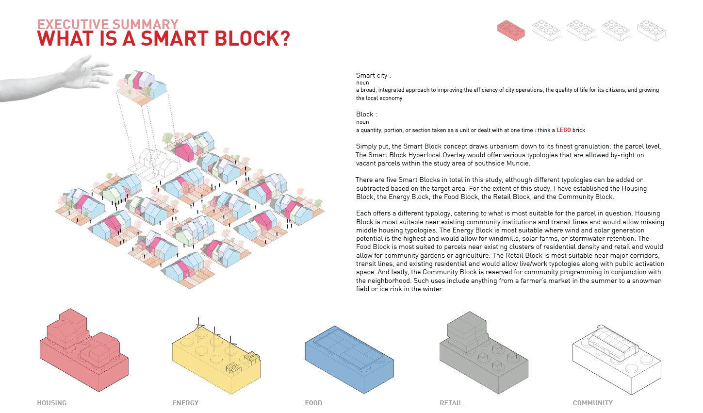
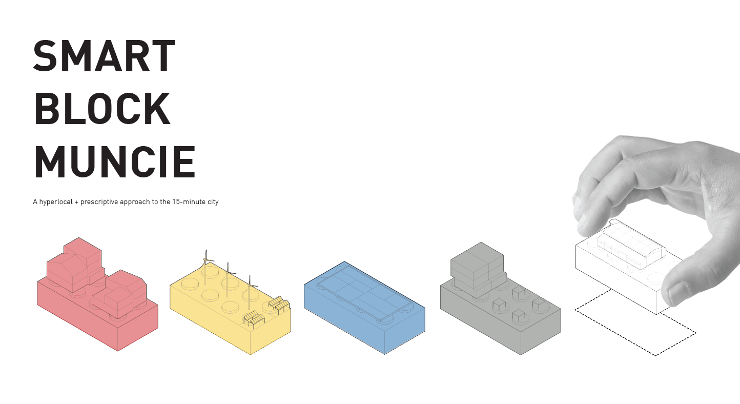
Smart Blocks
What→
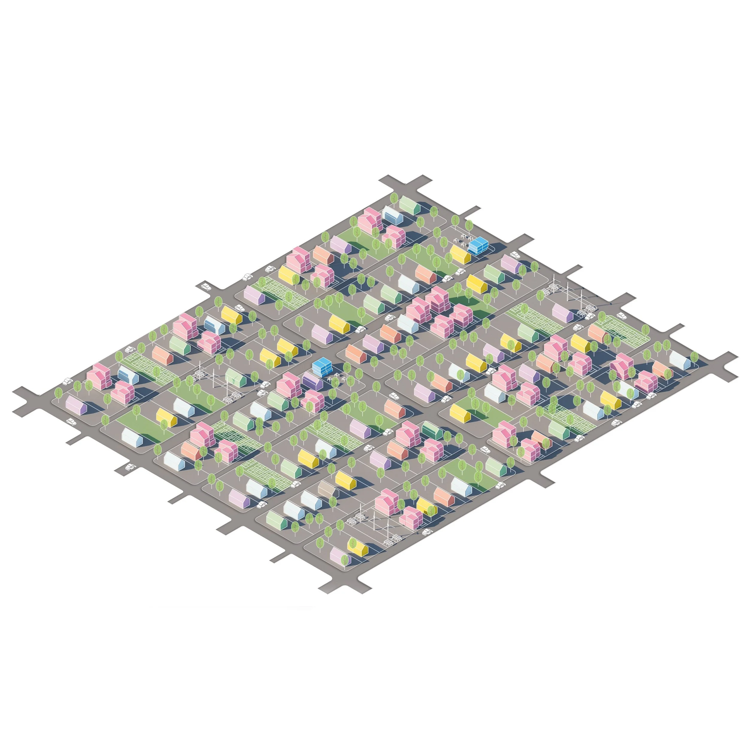
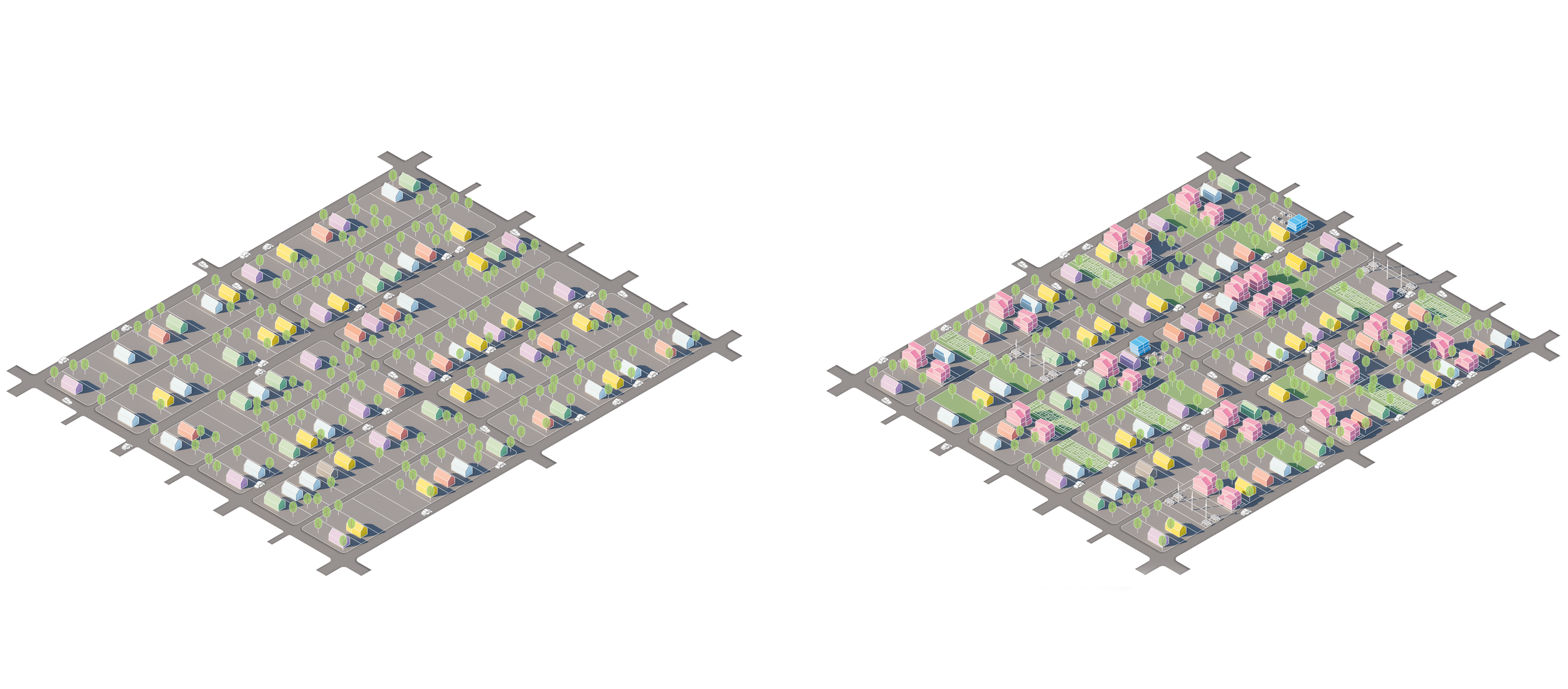
The Smart Block model ideates an approach to build a more resilient and sustainable Muncie while allowing for flexibility and breaking up the rigidity of normal land-grabbing necessary for development. The Smart Block concept thinks of vacant parcels as an urban patchwork to plug in different uses and typologies a specific community block needs. Different typologies of Smart Blocks would work together in adjacent or nearby parcels to accommodate the needs of residents while allowing the municipality the promise of an equitable, well-connected, and sustainable future.
In Rust Belt cities such as Muncie, Indiana, deindustrialization, population loss, and job dispersion has led to mass land vacancy, diminished tax revenue, and aging infrastructure.

The Opportunity →
The role of planning has for far too long been focused on reactive rather than proactive approaches to dealing with issues facing our cities. Antiquated zoning laws, typical developmental processes, and bureaucratic red tape have held back communities from making changes necessary to compete and survive in the 21st century. Euclidean zoning has done nothing to ameliorate the situation, with the strict separation of uses often coming at the expense of property tax revenue, community building, and quality of life. Separating by use often requires the usage of our car which places a disadvantage to low-income households while encouraging further sprawl, much of which is economically disadvantageous to a municipality. Over time, the cost of providing services to less-dense areas are higher than the property tax revenue generated. In a city like Muncie that is desperate for revenue sources, the astute leader must not succumb to the quick payoff of suburban growth in lieu of more economically sustainable infill. This study analyzes the possibility for this planning innovation in a study on the southwest side of Muncie abutting the Hoyt Avenue corridor.
The Methodology→
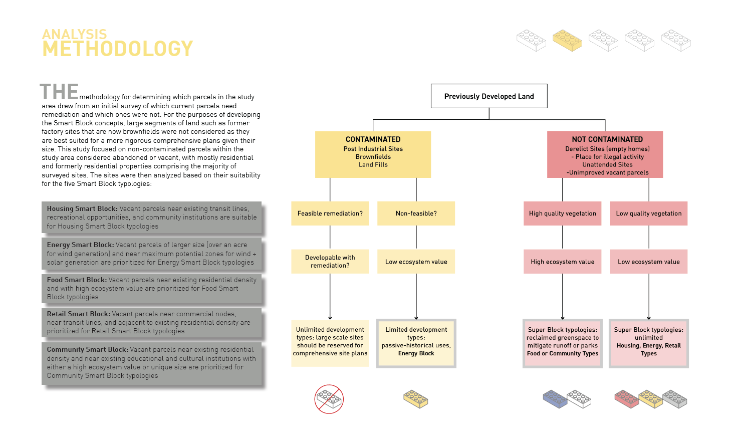
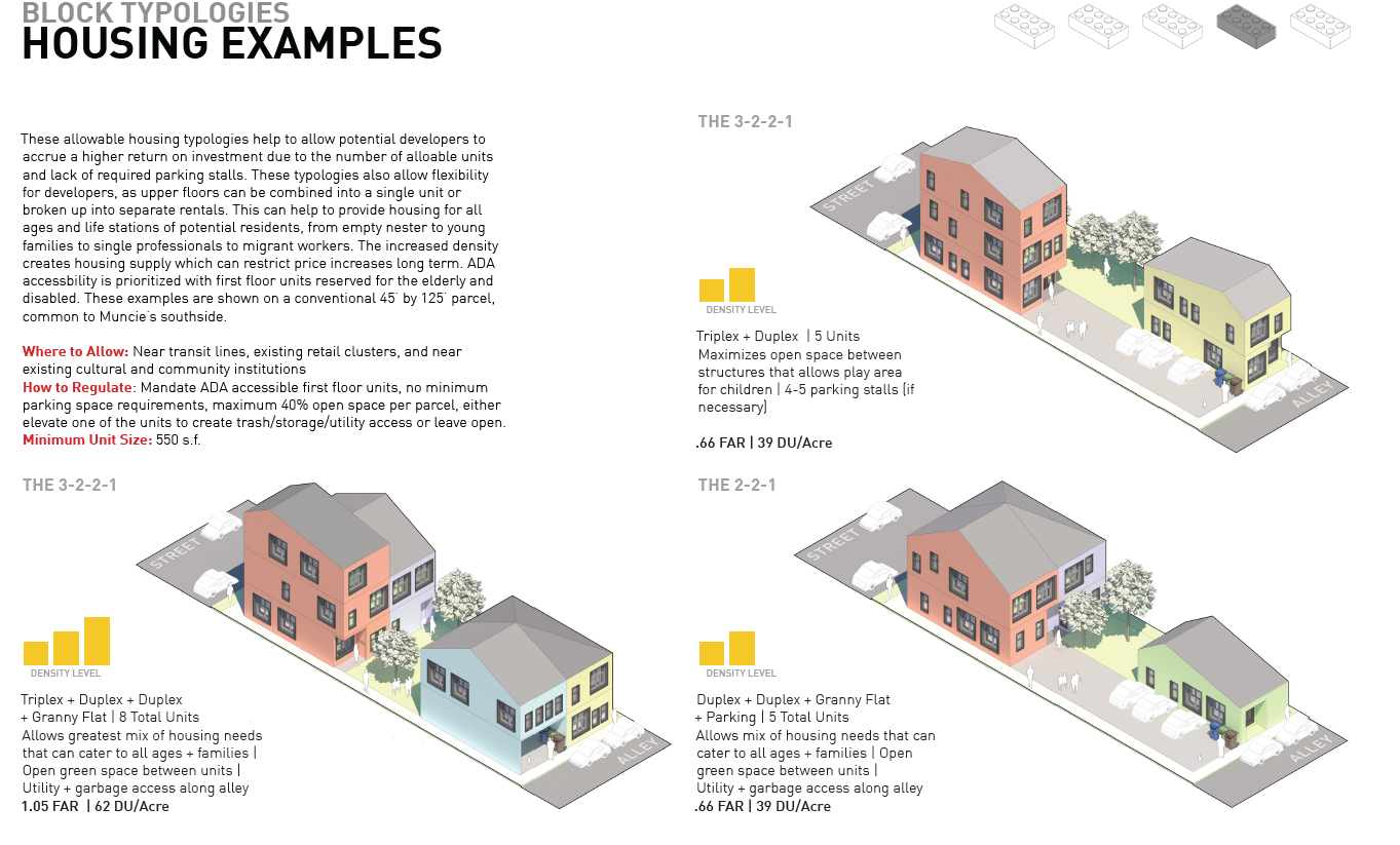
The methodology for determining which parcels in the study area drew from an initial survey of which current parcels need remediation and which ones were not. For the purposes of developing the Smart Block concepts, large segments of land such as former factory sites that are now brownfields were not considered as they are best suited for a more rigorous comprehensive plans given their size. This study focused on non-contaminated parcels within the study area considered abandoned or vacant, with mostly residential and formerly residential properties comprising the majority of surveyed sites. The sites were then analyzed based on their suitability for the five Smart Block typologies: