Our Work
Great places don't happen by accident.
They emerge through intention, process, and design. That process starts with evidence: we dig into the data that explains how a community actually works, then translate it into stories that align communities and guide decisions. From site-specific strategies to regional frameworks, we use that foundation to unlock development potential — creating places that are vibrant, adaptable, and built to grow with people over time.
 Community Engagement · Urban Planning
Mass Ave Next Vision Plan
 Community Engagement · Development Strategy · Urban Planning
Northwest Landing Vision Plan
 All Services
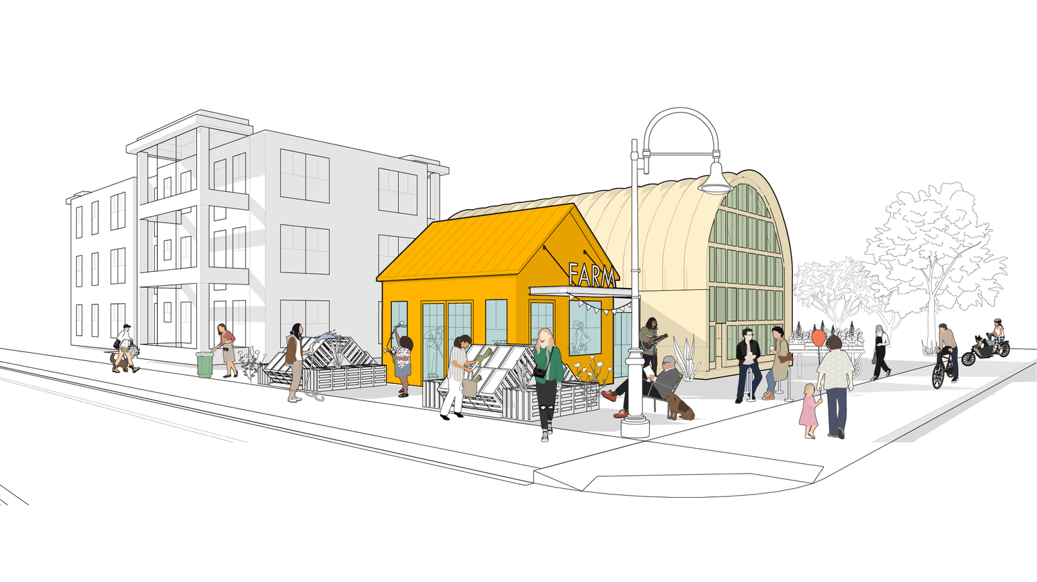
Urban Farms Toolkit
 Community Engagement
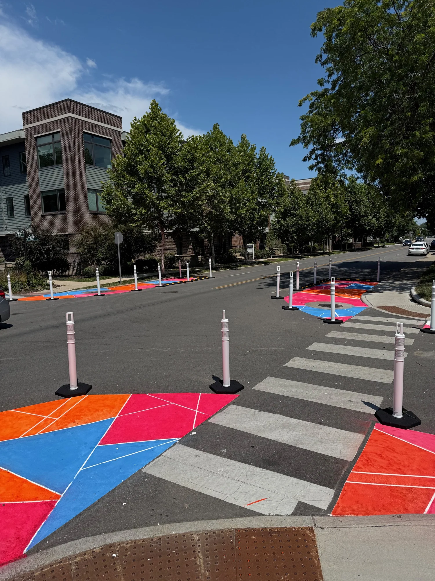
10th Street Street Traffic Calming Initiative
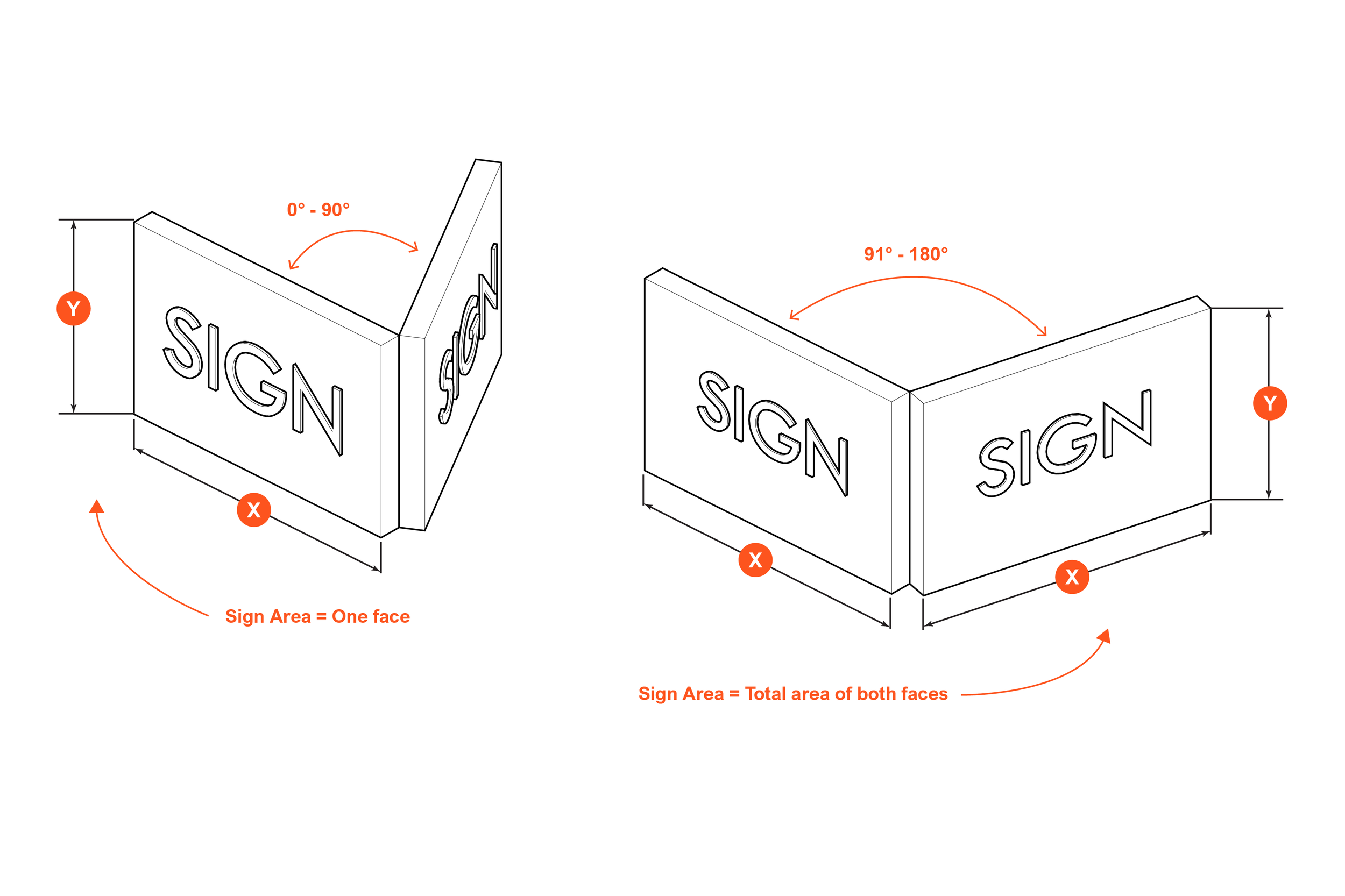
 Codes & Ordinances
Rockville Zoning Code
 Development Strategy · Urban Planning
10 East Arts Corridor Strategy
 Development Strategy · Urban Planning
Infilling Carolina

Urban Farms Toolkit →
📍North America
Urban Design & Planning | Land Use + Development
In our Urban Farms Toolkit, we translate complex zoning, land-use, and food-system policy into a clear, visual framework cities can actually use. The goal: help municipalities turn underutilized land into productive urban farms that support public health, local economies, and long-term resilience.
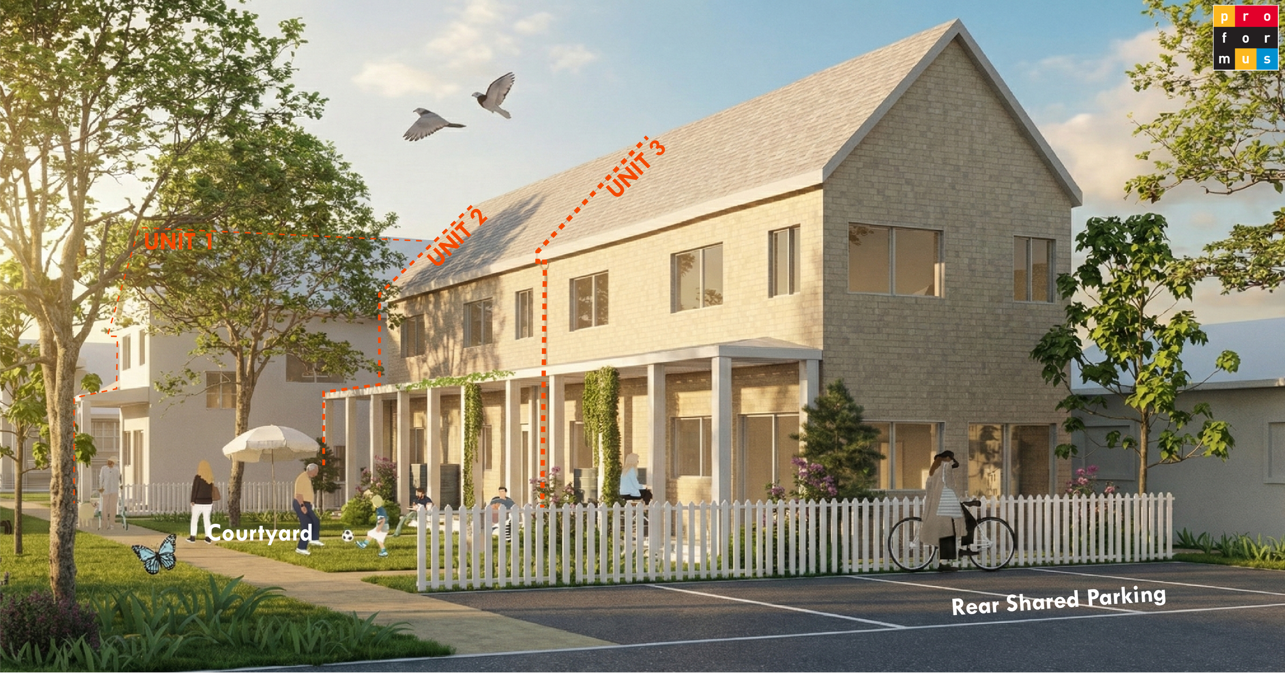
Infilling Carolina →
📍North Carolina, USA
Placekeeping | Urban Design & Planning
We were hired to visualize what upzoning in-demand parcels in three areas of the state could look like for future infill. We focused on Charlotte, Raleigh, and areas in the Research Triangle.
Rockville Zoning Code →
📍Rockville, Maryland
Urban Design & Planning | Land Use + Development
In our latest collaboration with ZoneCo, we helped translate Rockville’s new Development Code into a clear and visually engaging graphic language. The goal: make zoning ideas intuitive, transparent, and usable for everyone.

PLANDanville →
📍Danville, Virginia
Urban Design & Planning | Land Use + Development
The updated zoning code and graphics transforms technical standards into an illustrated guide for good urbanism, ensuring that design intent and policy speak the same language in southern Virginia.
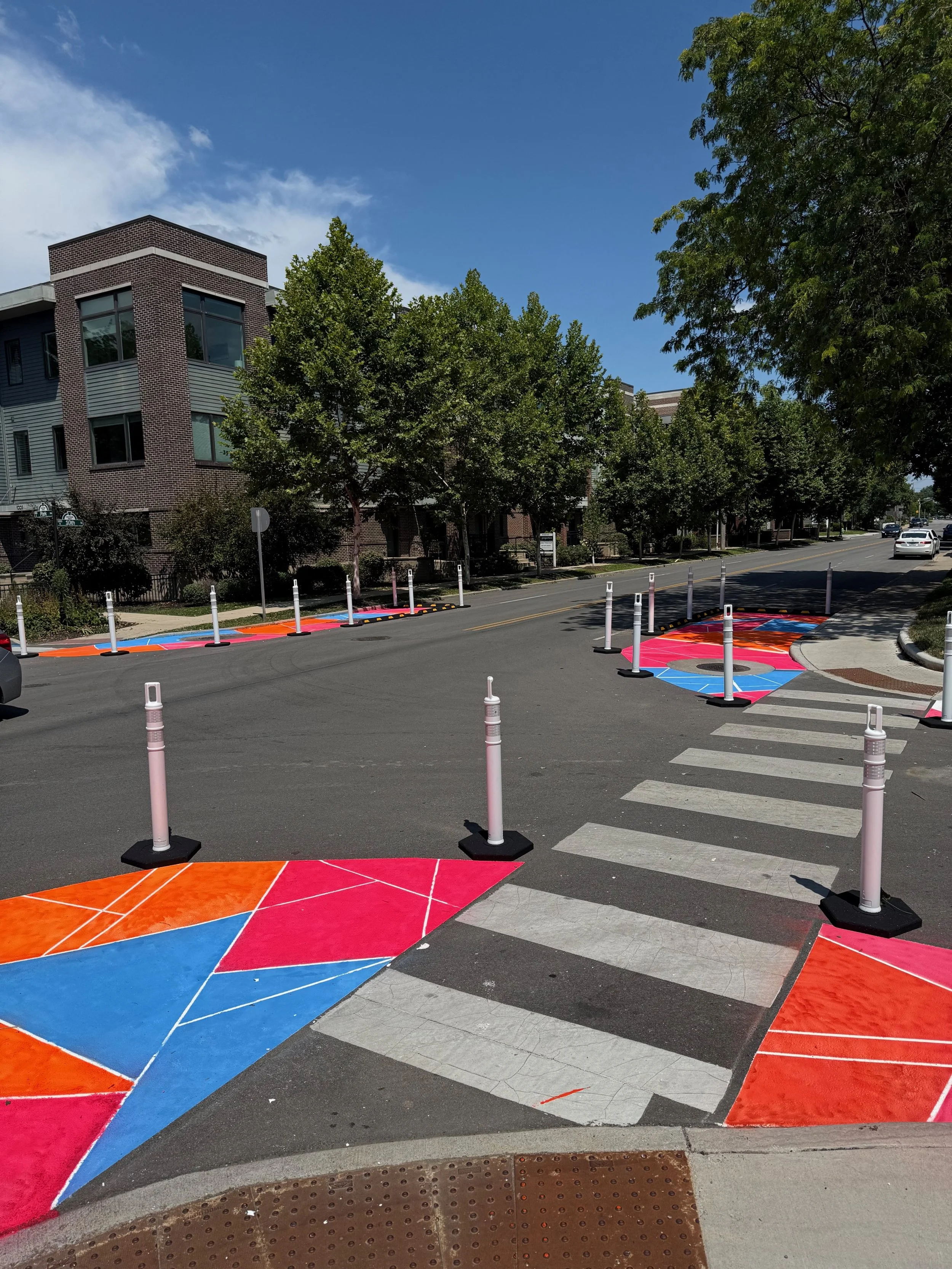
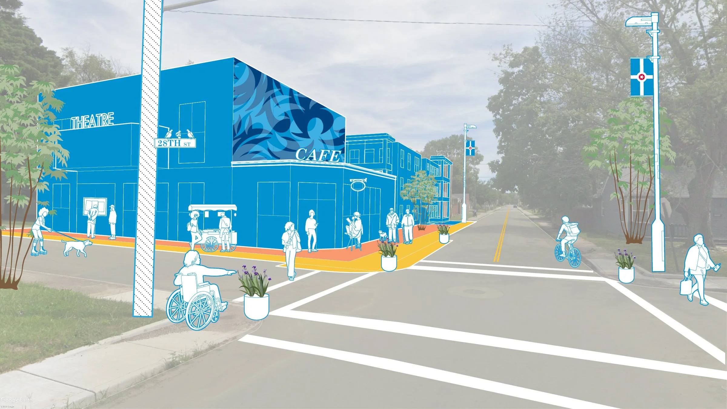
Chatham Arch 10th Street Traffic Calming Initiative →
📍Indianapolis, Indiana
Placekeeping | Urban Design & Planning
Our tactical urbanism project in the historic Chatham Arch neighborhood of Indianapolis will transform two key intersections, 10th Street & Park Avenue and 10th Street & Broadway—into age-safer spaces with curb bulb outs. We are partnering with AARP to complete the neighborhood’s vision.
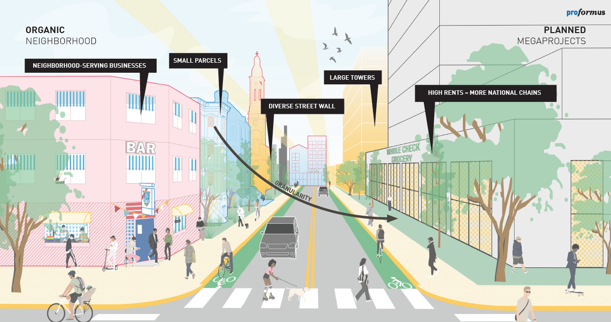
Thinking Big by Thinking Small →
📍Chicago, Illinois
Urban Design & Planning | Land Use + Development
In our latest white paper, we introduce ChiGRUPPEN and the Hyperlocal Parcel Model, a new development framework designed to break up massive project sites into smaller, community-scaled pieces. Instead of waiting for a single developer to shape entire neighborhoods, this model empowers everyday Chicagoans - through individual parcels or cooperative half-blocks—to build the city from the ground up.

Smart Blocks →
📍Muncie, Indiana
Urban Design & Planning | Land Use + Development
The Smart Block Model ideates an approach to build a more resilient and sustainable Muncie while allowing for flexibility and breaking up the rigidity of normal land-grabbing necessary for development.
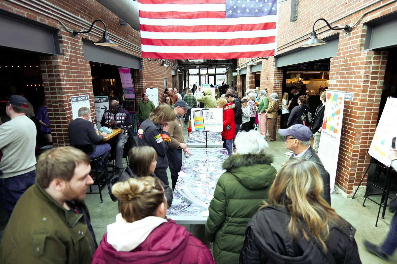
Mass Ave Next→
📍Indianapolis, Indiana
Placekeeping | Urban Design & Planning | Mapping
The Mass Ave Certified Planning engagement is a community-led initiative that will provide a framework to shape the public space network in the Mass Ave Arts and Cultural District (MACAD) for the next five years as part of the City of Indianapolis’ Certified Planning Process.
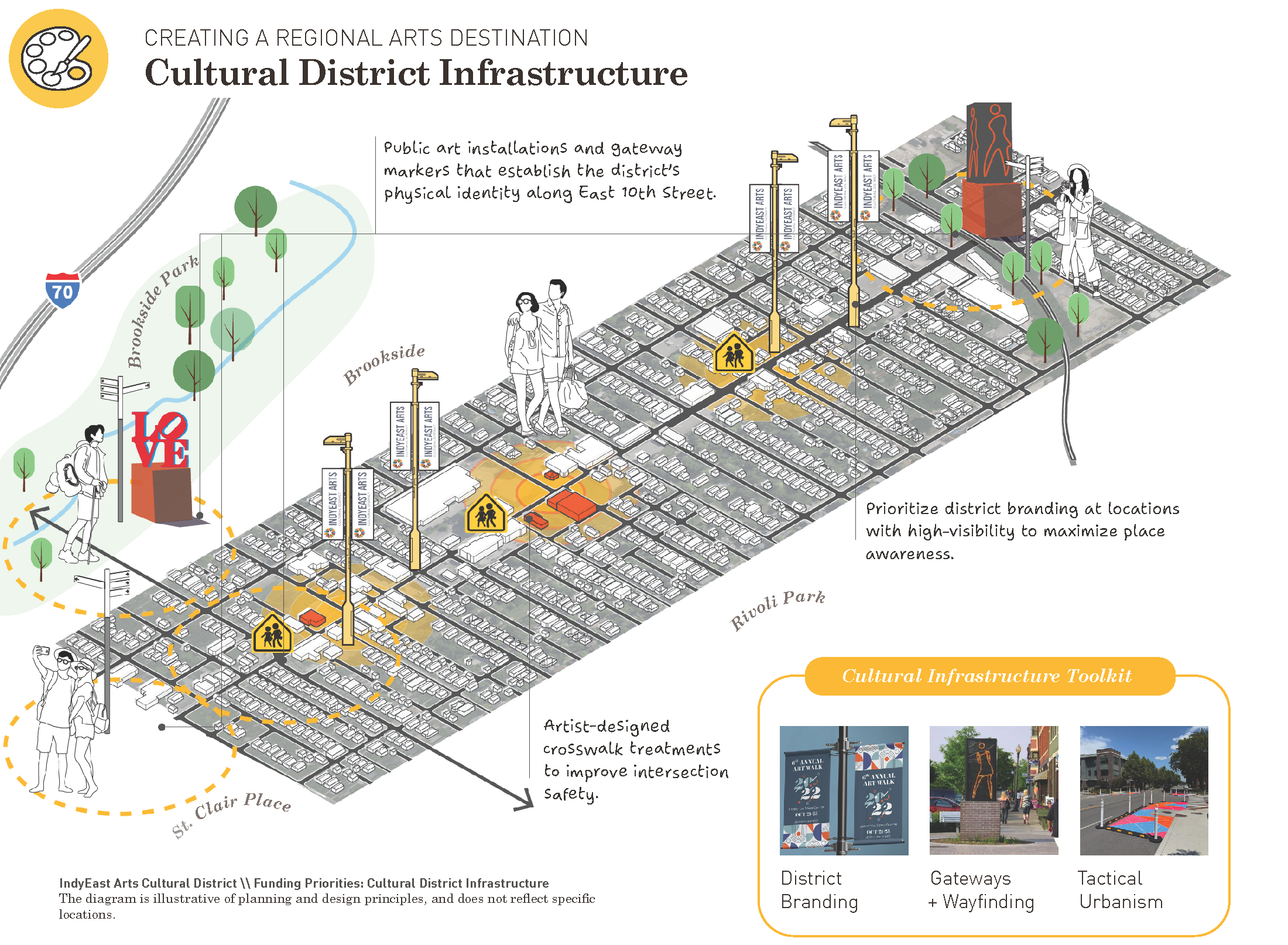
10East Arts Corridor→
📍Indianapolis, Indiana
Placekeeping | Urban Design & Planning | Mapping
10East Arts Cultural District is an emerging arts corridor fostered by long-time neighborhood institutions. Proformus was contracted to help develop sustainable and actionable development and arts strategies for the near-future to help guide the district build upon existing assets and drive 10th Street to its full potential.

Indy Health District*→
📍Indianapolis, Indiana
Placekeeping | Urban Design & Planning | Mapping
Jeffery Tompkins, founder at Proformus, served as a co-lead planner for the 1,500-acre Indy Health District—the largest planned health innovation district in the Western Hemisphere. In partnership with Perkins&Will as part of the METICULOUS team, he helped shape the urban framework surrounding IU Health’s $4.3B downtown hospital investment.
Northwest Landing Vision Plan →
📍Indianapolis, Indiana
Placekeeping | Urban Design & Planning | Mapping
Northwest Landing is a fine-grained near-northwest-side neighborhood with good bones and deep roots, steadying after decades of disinvestment. Proformus partnered with the Aspire Higher Foundation to develop its Quality of Life Vision Plan: a roadmap shaped over eight months by more than 196 residents that pairs honest existing-conditions analysis with fundable, parcel-level strategies for growth on the neighborhood's own terms, without pushing anyone out.