
Codes & Ordinances
Rockville Zoning Code
Rockville, Maryland
What
Proformus partnered with ZoneCo to assist the City of Rockville, Maryland in launching its new, citywide zoning code — a once-in-a-generation update aimed at making development regulations more intuitive, visual, and people-centered.
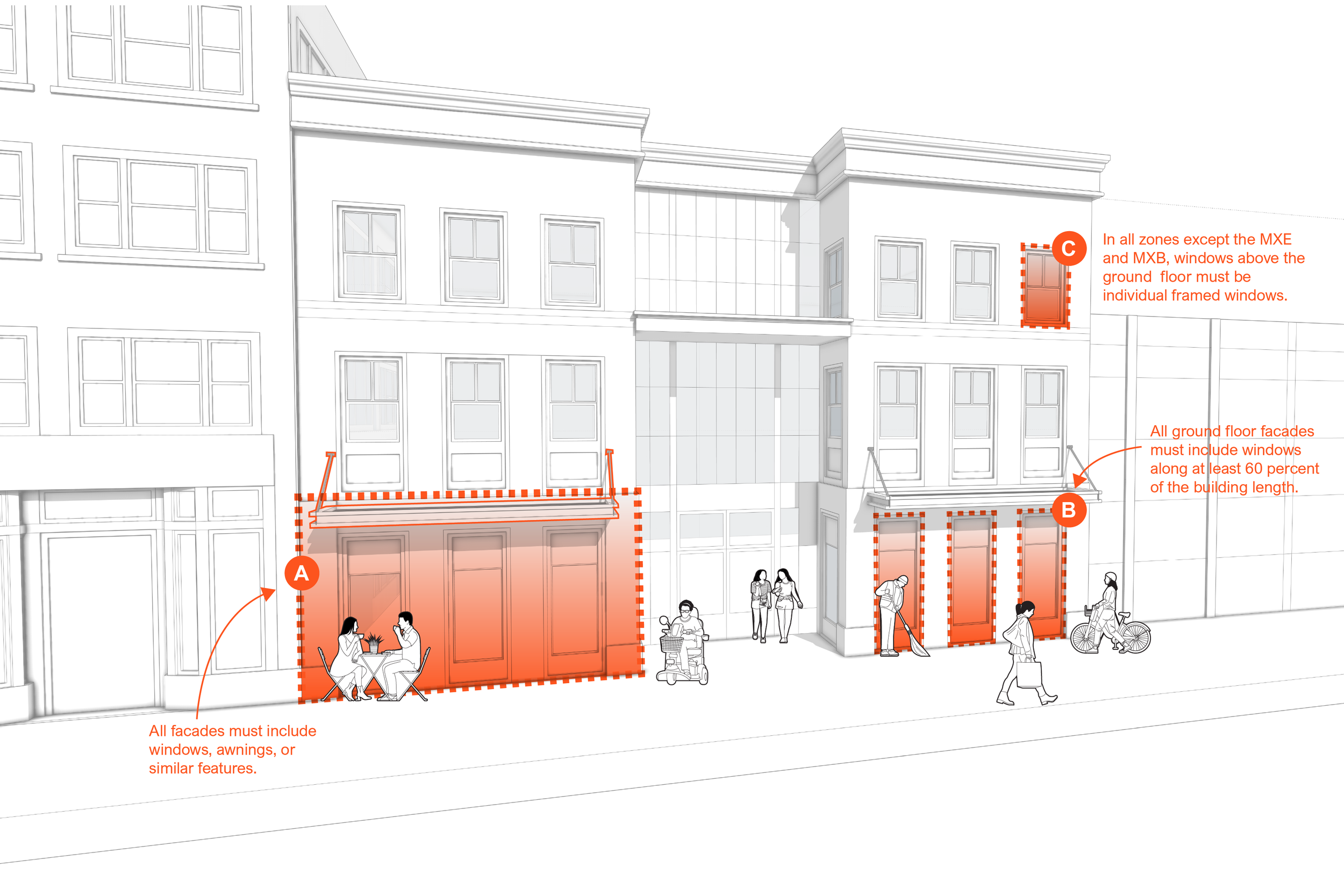
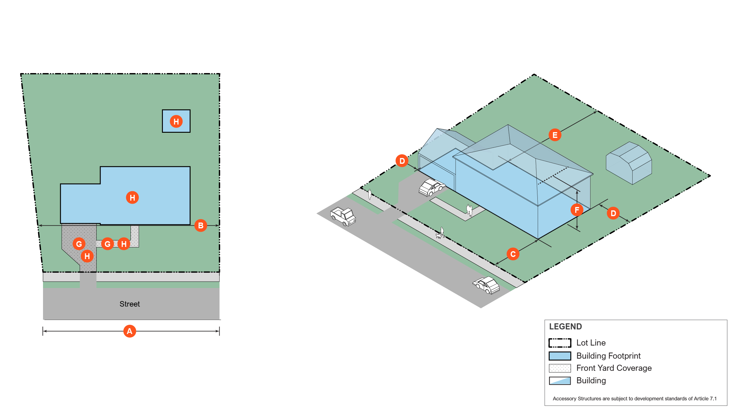
Our task: create a compelling set of graphics that translates dense technical language into a clear visual system — one that communicates how Rockville's neighborhoods can evolve with clarity and confidence. Working closely with ZoneCo's planning team, we designed a suite of diagrams, maps, and illustrative typologies that bring the code to life, showing how form, frontage, and scale work together to shape livable streets and connected communities.
This collaboration underscores our shared belief: zoning should not just regulate but inspire. By making the code visual, accessible, and engaging, Rockville's new framework helps residents, developers, and city staff alike see what good growth looks like — and how to achieve it.
A code you can read.
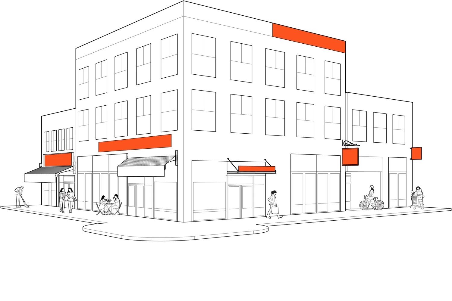
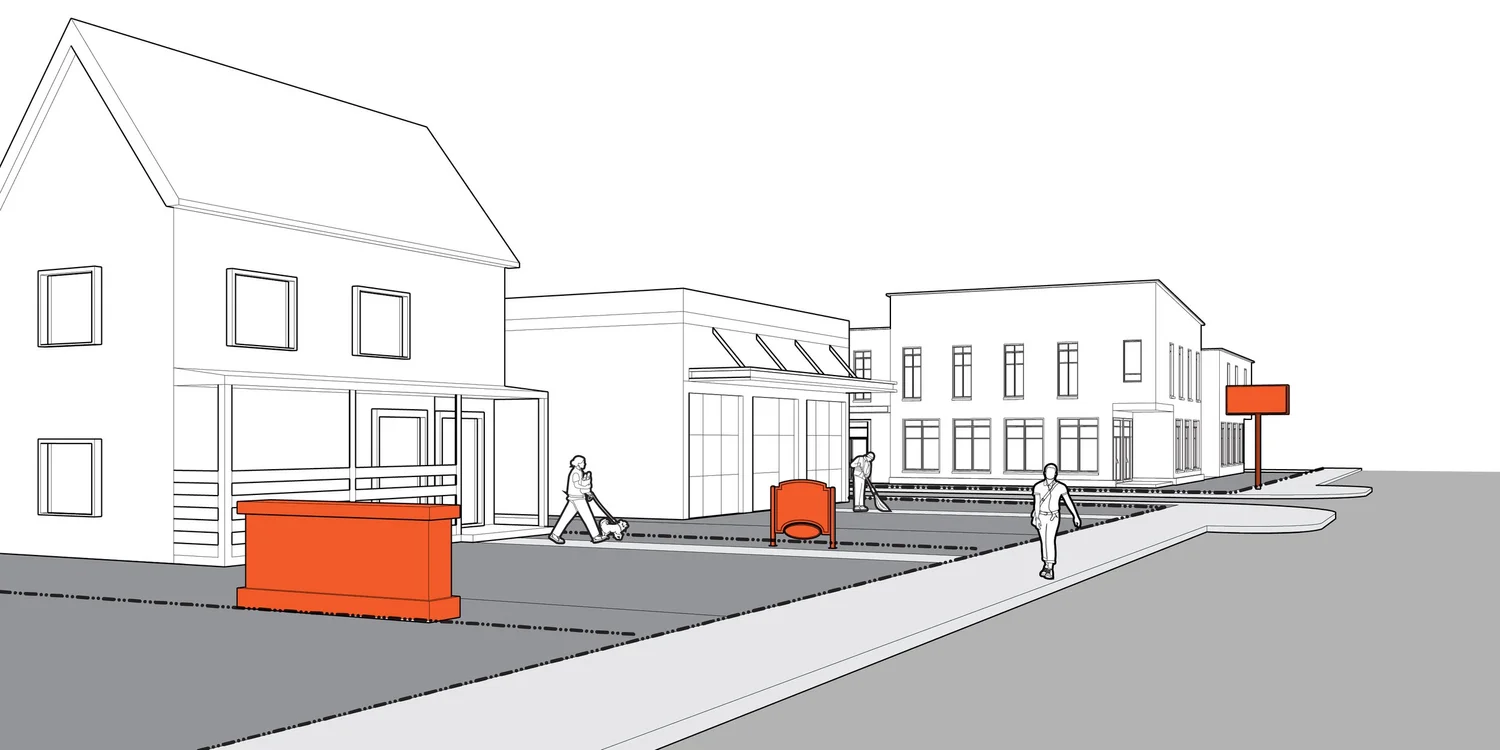
Most zoning codes are walls of text that only specialists can navigate — which means the people they govern can't see themselves in them. Rockville's update flips that: every standard that shapes a street, a storefront, or a front yard gets a drawing. When the rules are visible, everyone can participate in what gets built.
Streets, illustrated
Lots & frontage
The signage suite
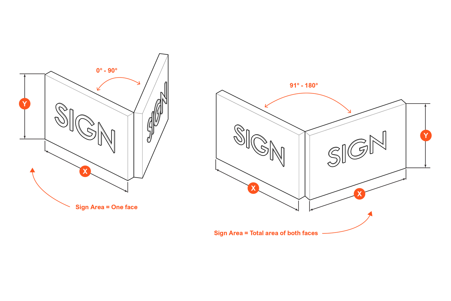
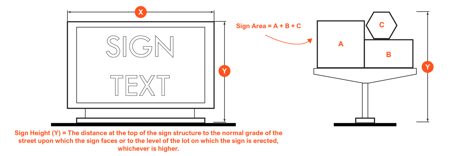
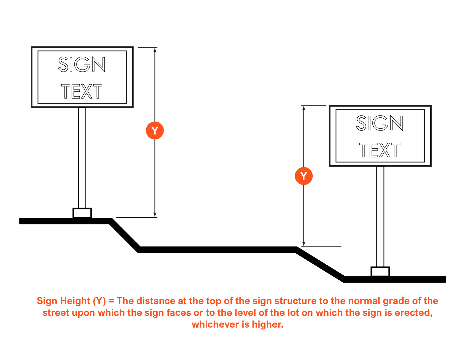
Sign regulations are where zoning codes get famously unreadable — area formulas, height datums, face counts. Drawn, they take seconds to understand.
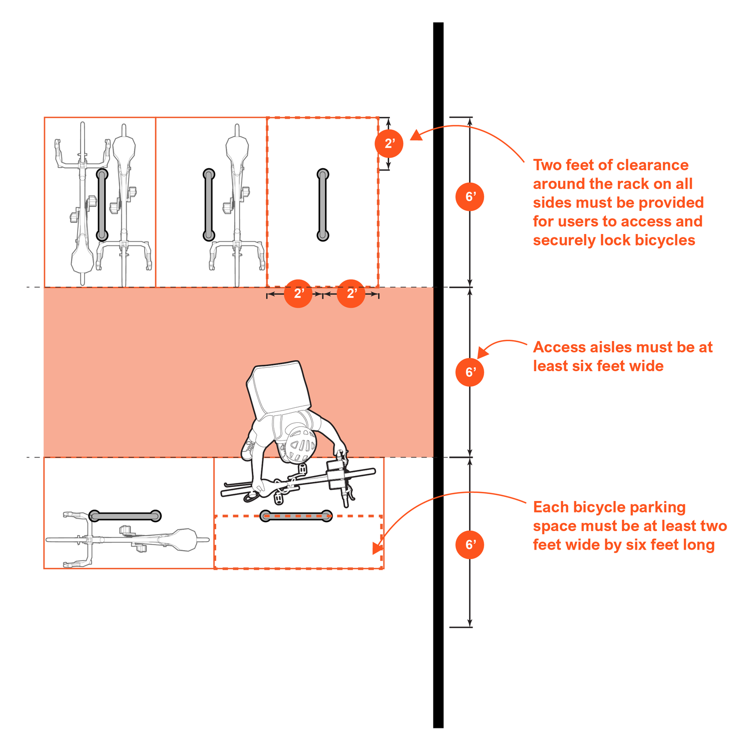
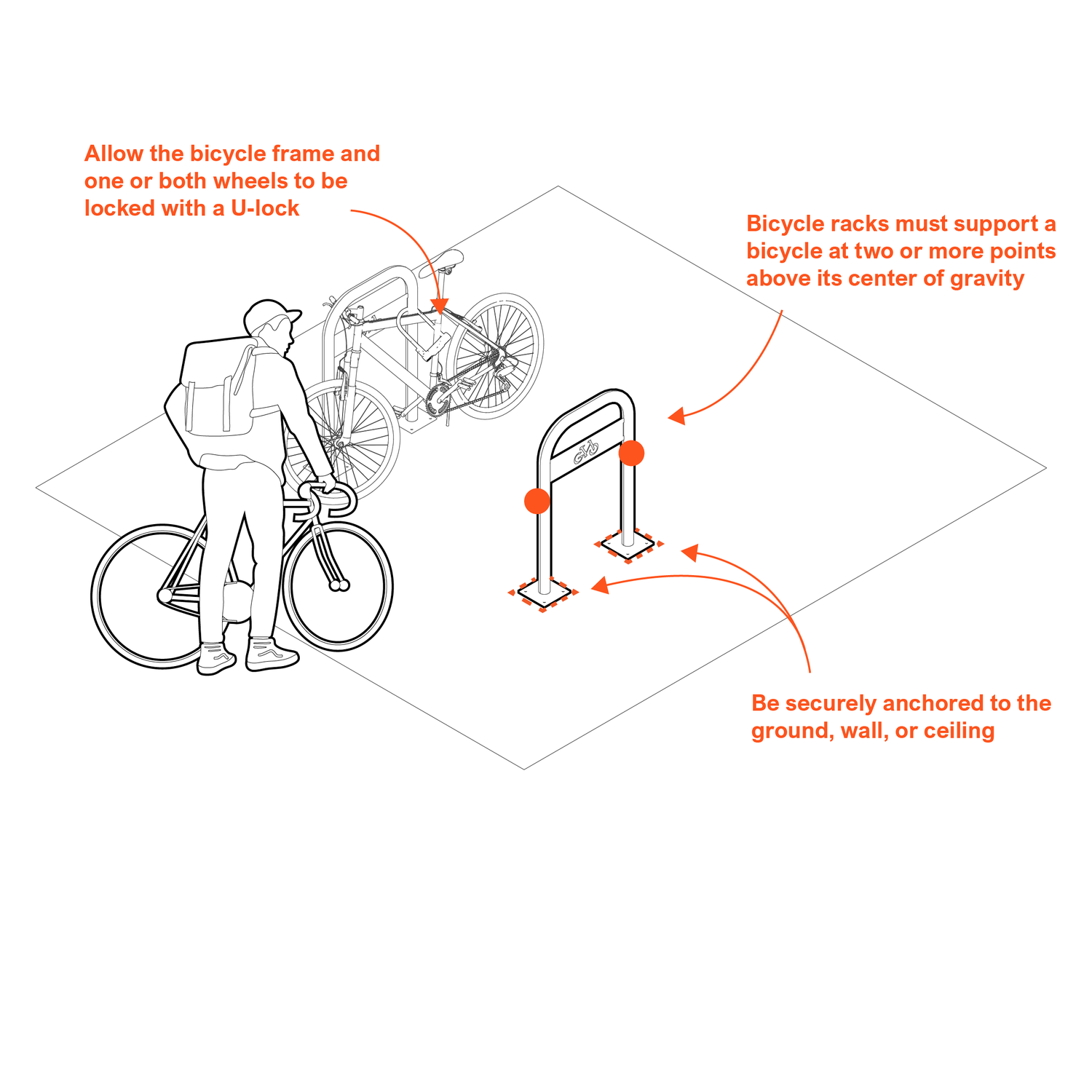
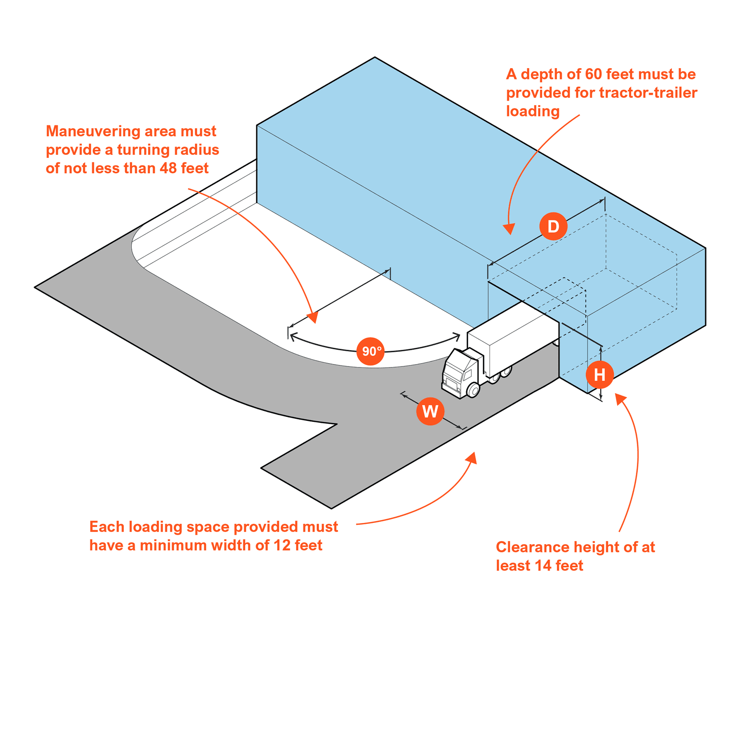
Bikes & parking
Project Details
- Client
- City of Rockville, Maryland
- Partner
- ZoneCo
- Location
- Rockville, Maryland
- Scope
- Citywide Zoning Code Graphics
- Status
- Completed
Key Services
- Zoning Strategy & Policy Alignment
- Code Illustration & Visual Standards
- Urban Design & Concepts
- Visual Storytelling & Graphic Design