
Pre-Development · Mixed-Use Design
Freight Street District
Elkhart, Indiana
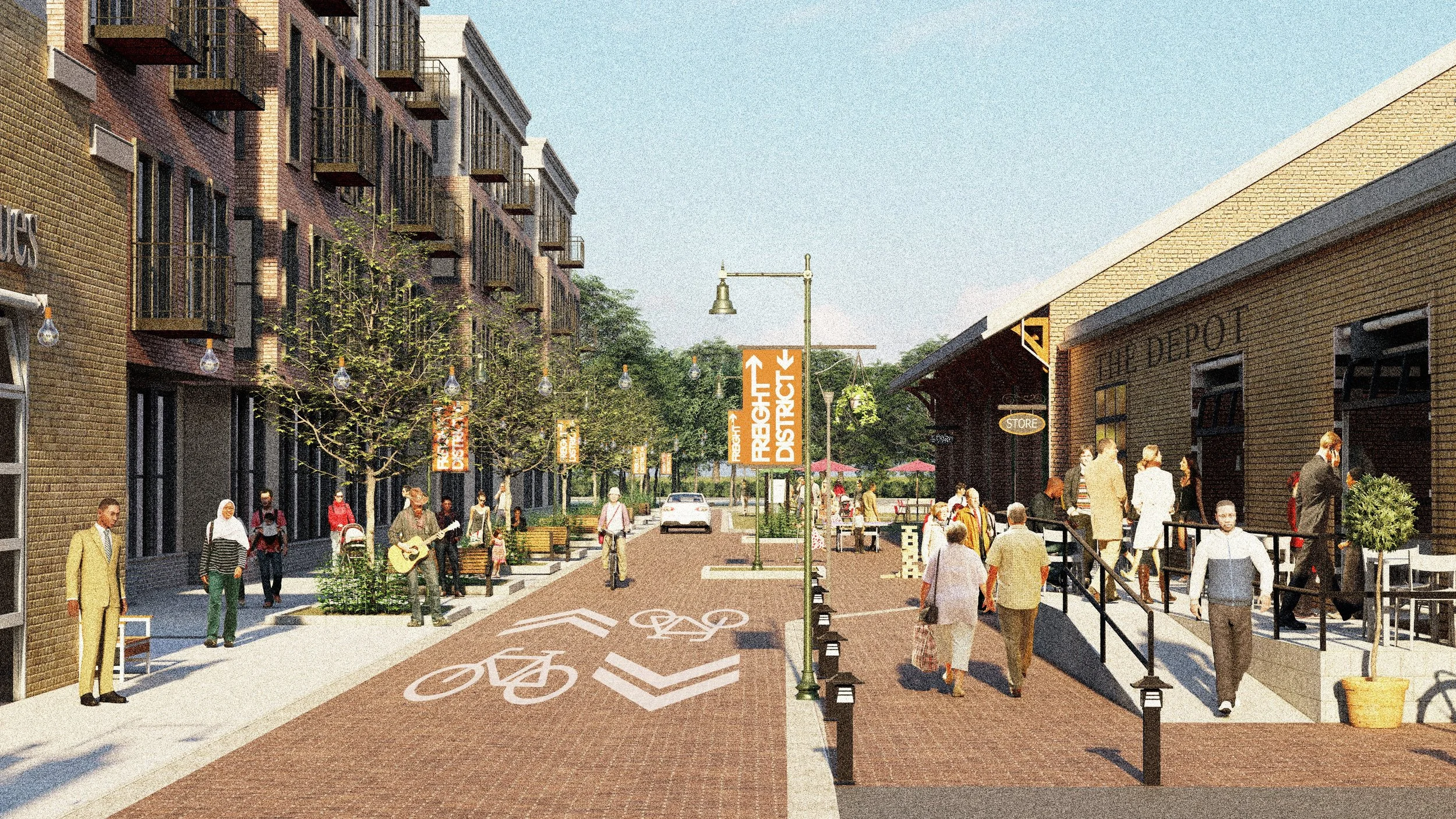
What
A pre-development concept for 1.6 shovel-ready acres between downtown Elkhart and its south neighborhoods. The City of Elkhart Redevelopment Commission solicited proposals to reimagine Freight Street, a block of South Main beside the National New York Central Railroad Museum, with up to $10 million in streetscape investment coming to the corridor and one hard constraint: the concept had to pencil without additional public investment.
The answer is a district, not a building. Two four-story buildings put 144 homes — studios through two-bedrooms — over street-level retail, and a 5,000-square-foot shared-street arcade of permeable pavers, vendor stalls, and shade trees links housing, commerce, and the museum campus into one destination. Zoning wasn't an obstacle to clear; the Central Business District's height, coverage, parking, and transparency standards were modeled first and used as the design brief.
This block was a railroad-era main street once — homes, hotels, and storefronts side by side — and the concept returns it to that work, at the scale the historic fabric already set. All aboard: Elkhart is headed to its next chapter.
A district, not a building
Elkhart, Indiana · Concept report, 2024 · Led as Design Director at METICULOUS for Garrison Frazier
The City of Elkhart put 1.6 acres on the table: a shovel-ready block of South Main between Freight and St. Joseph Streets, next door to the National New York Central Railroad Museum, with up to $10 million in streetscape investment coming to the corridor. The ask was a mixed-use vision that could be built without additional public money.
Our answer treats the site as a connector, not a parcel. Downtown Elkhart, South Main Street, and the Tolson Community Center are this area's greatest strengths — and the Freight Street District boldly connects them. Locally-focused retail, 144 homes, and a shared-street arcade tie the museum, the depot's mercantile history, and the corridor's coming streetscape into one destination.
The program
Reading the site first
Concepts don't start with massing; they start with evidence. We mapped the block's parcels, land uses, and access points to establish highest and best use — which edges want storefronts, where vehicular access can live without breaking the pedestrian street, and where underused ground holds district-scale opportunity.
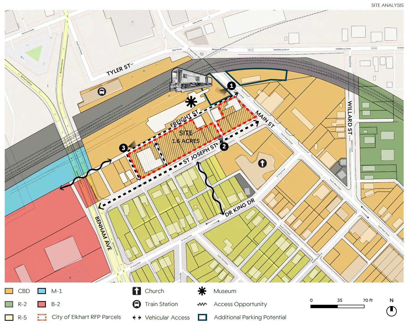
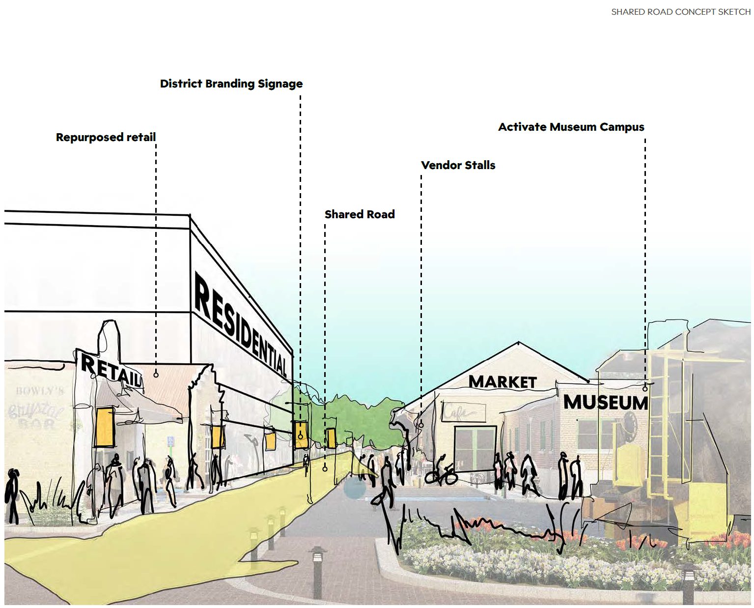
The analysis set the brief for every edge: face Main Street with retail, open the western edge to the museum campus, calm Freight into a shared street, and hold the block's center for the arcade. Only after the ground told its story did the buildings get drawn.
Zoning as the design brief
Good pre-development work reads the code the way a developer's lender will. Before a single unit was drawn, we modeled Elkhart's Central Business District standards as a physical envelope — four rules that shaped the massing before the architecture began.
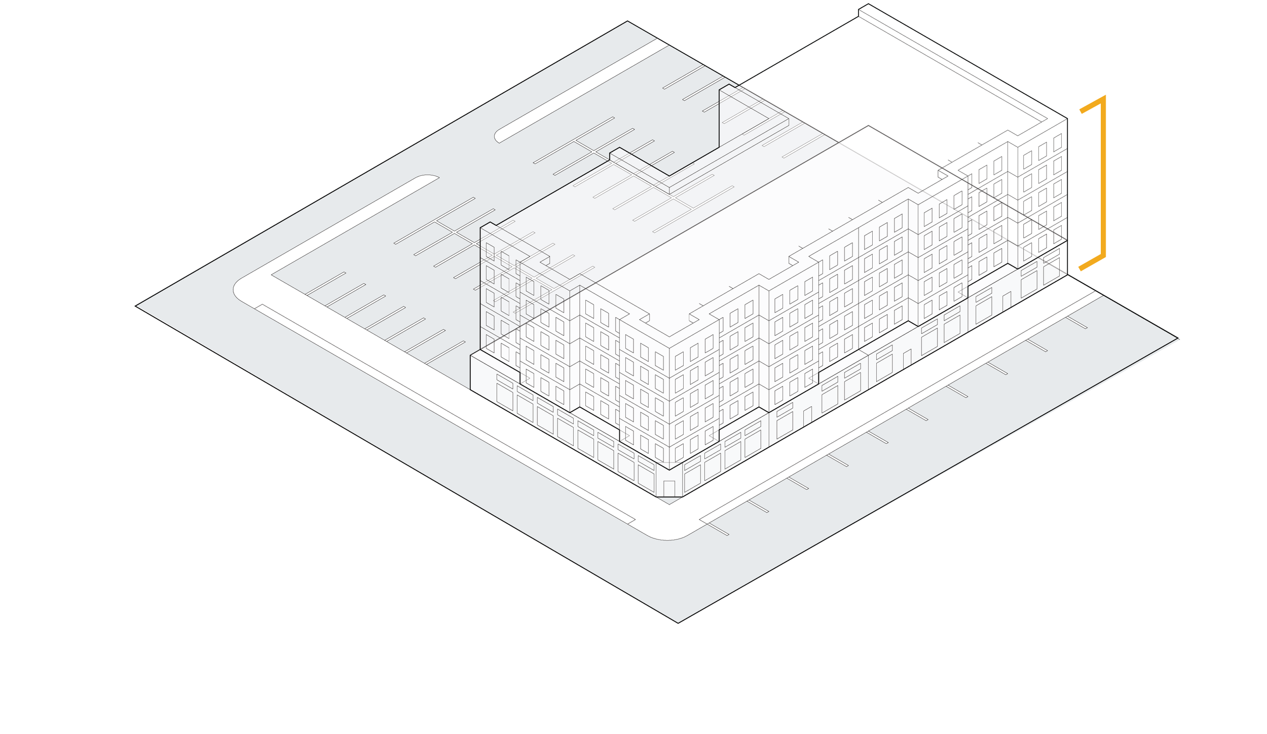
20 ft minimum · 65 ft maximum.
The CBD wants buildings, not pad sites: a two-story floor is the entry ticket. The district builds to four stories — dense enough to carry the corridor, scaled to the historic Main Street fabric it joins.

75% maximum lot coverage.
The remaining quarter of the site isn't leftover — it's the point. The uncovered ground becomes the arcade, the planted pockets, and the covered seating that make the district a place rather than a project.
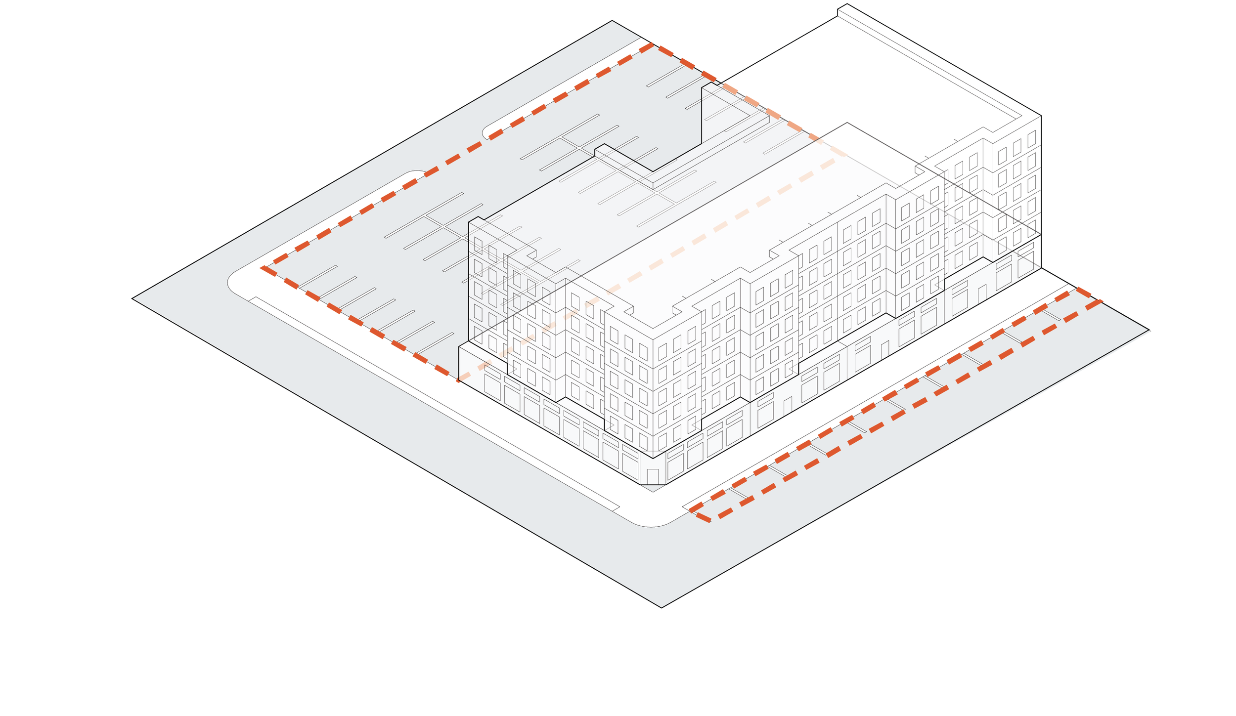
1 stall per unit residential · 1 per 300 GSF retail · never in the front yard.
CBD zoning cuts the requirement by up to half for buildings with two-plus occupiable floors, and lets on-street stalls count toward adjacent parcels — code mechanics that make the pro forma work without paving the district.
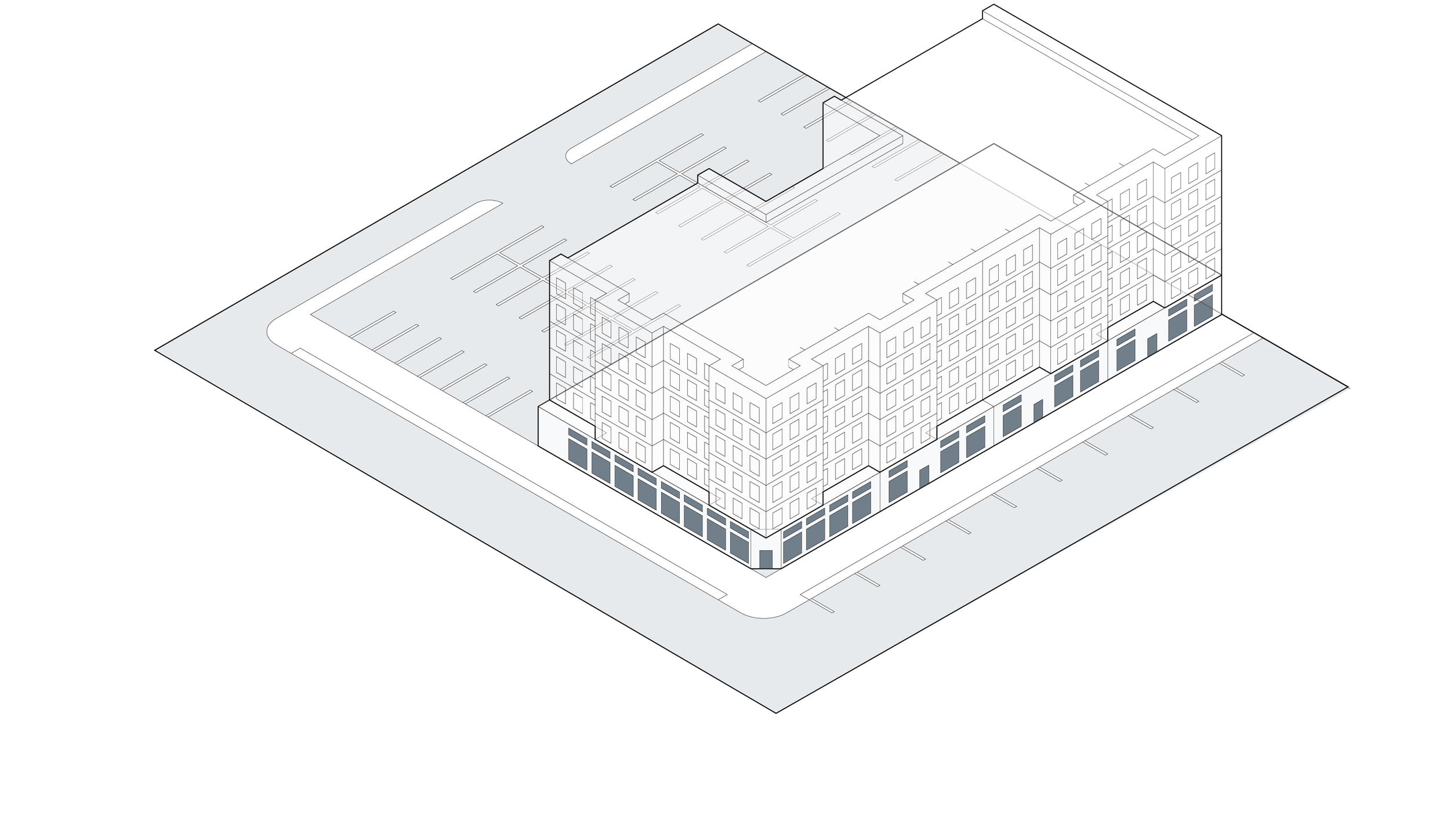
50% first-floor transparency.
Half the ground floor must be glass. The code is asking for storefronts and eyes on the street; the design answers with retail frontage, display windows, and outdoor seating scaled to people.
Elkhart CBD dimensional standards, modeled on the site.
Building blocks of the district
The envelope resolves into two buildings and a street. Building A puts 40 apartments over 4,000 square feet of commercial space on Main Street — a first-floor "third place" where the neighborhood meets its daily needs. Building B carries 104 homes with street-level walkups along St. Joseph. Between them, the 5,000-square-foot Freight Street Arcade — a shared street of permeable pavers, shade trees, vendor stalls, and a café — links housing and destination to the museum campus next door.
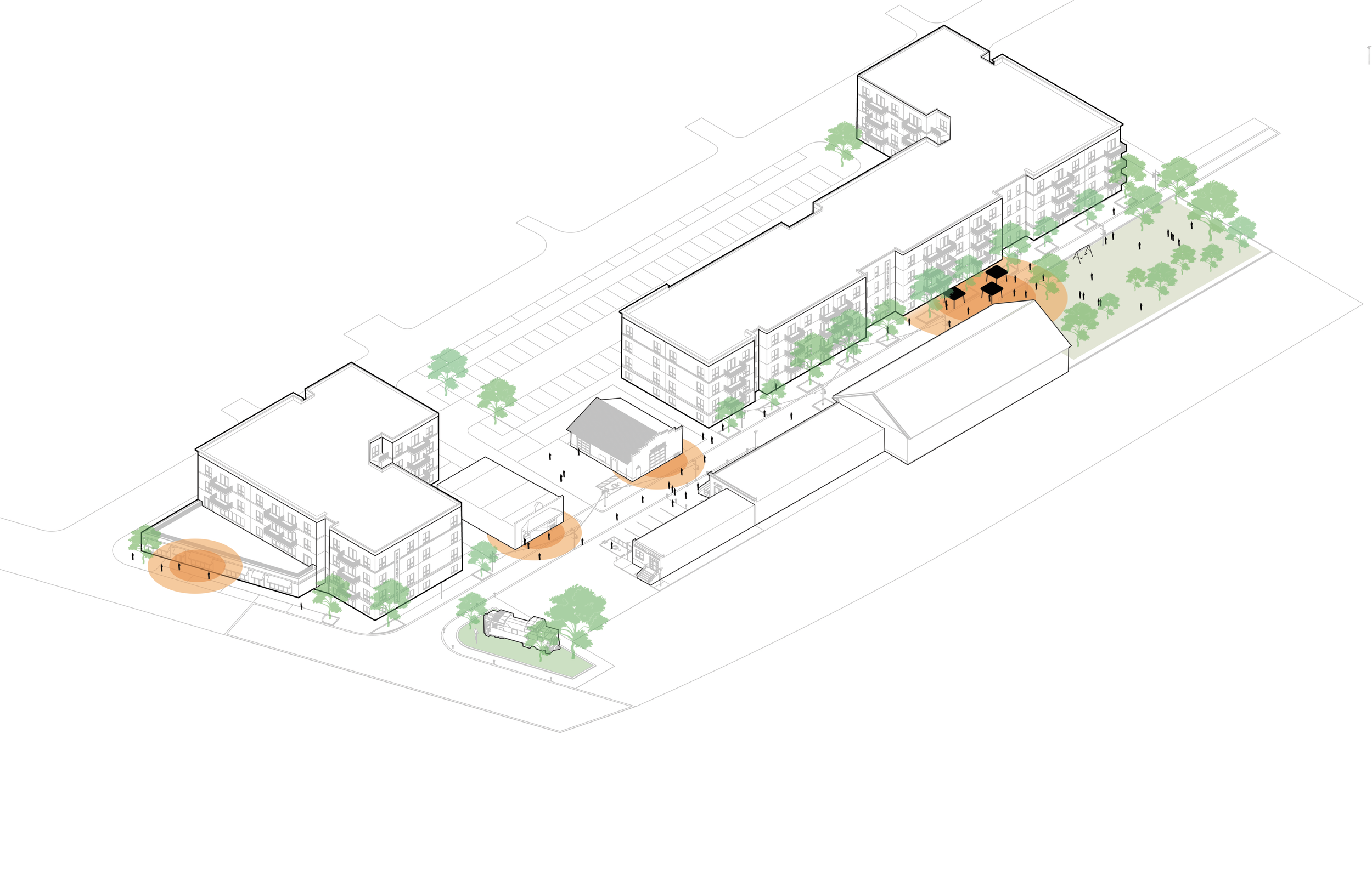
The mix does deliberate work: studios through two-bedrooms across both buildings keep the district open to a wide range of incomes and life stages, boosting residential density south of downtown and connecting the momentum of Tolson and south Elkhart with the heart of the city.

This block has always been mixed-use
Main Street in Elkhart emerged as a railroad hub in the late nineteenth century. With the Michigan Southern & Northern Indiana Railroad's arrival in 1851, the corridor filled with businesses, hotels, and homes side by side — commercial, residential, and industrial uses blending block by block. The 1910 Sanborn maps show it plainly: this ground has carried density and mix before.
The design honors that record rather than inventing one. Facades break at the historic lot rhythm, storefronts meet the sidewalk the way the depot-era buildings did, and the district's New Urbanist bones come straight from the Benham Avenue Comprehensive Plan. At the Freight District, the past is present.

Project Details
- Client
- Garrison Frazier
- Location
- Elkhart, Indiana
- Type
- Mixed-Use Pre-Development Concept
- Site
- 1.6 Acres, RFP Response
- Program
- 144 Homes · 4,000 SF Commercial · 5,000 SF Arcade
- Role
- Design Director, METICULOUS
- Status
- Concept Report, 2024
- Outcome
- $1.5M READI Grant Awarded to Elkhart, 2026
Key Services
- Site Analysis & Highest-and-Best Use
- Programming & Test Fits
- Development Scenario Planning
- Urban Design & Concepts
- Massing & Streetscape Design
- Zoning Envelope Analysis
- Comprehensive Plan Alignment